Road Stream Crossings
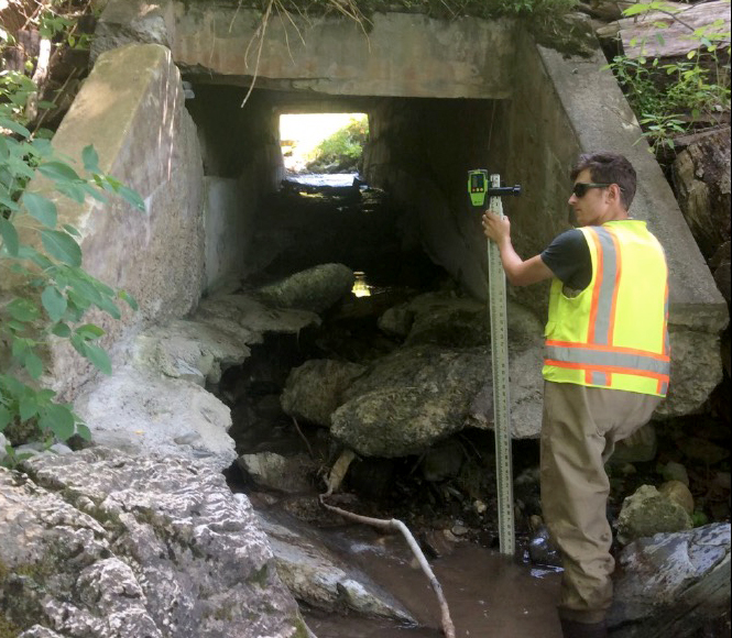
The Town of North East Road-Stream Crossing Management Plan was produced by The Housatonic Valley Association in 2020. Its purpose was to identify which stream-road crossings were in the highest need of replacement. The priority was determined by “flood risk, potential to restore stream habitat connectivity, and maintenance need.” Additionally, this document provides “Best Management/Design Practices” to address these concerns, as well as suggest structures designed to need less maintenance and have a longer lifespan, thus being more cost effective in the long term. This project has been funded in part by The Climate Smart Community Grant Program, Title 15 of the Environmental Protection Fund through the NYS Department of Environmental Conservation.
This plan is available via these links:
HOUSATONIC VALLEY ASSOCIATION
HOUSATONIC VALLEY ASSOCIATION
Inventoried and assessed for flood risk, “animal passage”—can creatures move freely to and fro—and upgrade priority were 150 North East culverts.
Comprehensive Plan
In their recent and thorough revision of the joint Town of North East and Village of Millerton Comprehensive Plan (2019), the authors recognized the vital importance of our local natural environment in numerous places. The Plan outlines many actions the Town of North East and Village of Millerton can take over the next 10 to 15 years to address their environmental vision and meet their goals. A major part of the plan’s opening statement is symptomatic:
The enduring theme of North East and its historic, vibrant Village of Millerton is its entrepreneurial spirit that benefits from its location within 100 miles of a major metropolitan area and its resource-rich landscape guided by a strong commitment to preserve the environment and ecosystems. We prioritize economic and environmental resiliency in the midst of climate disruption.
View or download the full plan here.
Flood Zones
The Town of North East Water Resources map shows delicate ecosystems protected by the state Department of Environmental Conservation: rivers, streams, ponds, lakes, and wetlands. Expanded outlines reveal areas that are vulnerable to flooding in extreme weather. Called a 100-year floodplain, these “rare” events are occurring more frequently due to climate change. The map also shows the areas where groundwater recharges the aquifers that are the source of the well water we all depend on. Protecting all these waters from chemicals and pollutants preserves the health of plants, animals, and humans. The flood map is available here.
A full size map is available in the Comp Plan Reference Appendix.
Parcel Access, another Dutchess County resource, has maps that show an additional level of detail: a 50-year floodplain. These areas are, of course, more prone to future flooding. Start here.
Significant Habitats
Significant Habitats in the Town of North East is an extensive survey of living ecosystems performed by Hudsonia in 2008 that mapped our entire town. The report details meadows, forests, swamps, marshes, and steep slopes, varied upland and wetland areas. North East contains large tracts of high-quality contiguous forests and wetlands as well as vernal pools and acidic bogs and a rarity in this region, marble knolls. Our town, Hudsonia says, is 92-percent “significant habitat.” Some of the native flora and fauna either identified or deemed likely are sensitive to human disturbance; some areas are vulnerable enough to be protected by conservation designations. Map available here.
A high-resolution map is included on page 88 of the 2019 Comp Plan.
The complete Hudsonia report is available here.
KRISTEN BELL
KRISTEN BELL
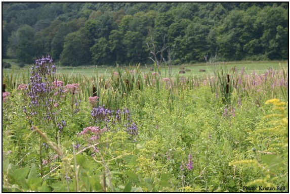
The Bog Turtle is an indicator species for a calcareous or limestone wet meadow: a highly specific habitat with the right moisture, minerals, food, and protection to accommodate a rich variety of species that form an ecosystem. Among them: Showy lady’s slipper, blue vervain, sweetflag, Aphrodite fritillary, bobolink, and ribbon snake.
Ag Districts
Agriculture is at the heart of our community. Designated agricultural districts include nine-tenths of the land in North East. The designation provide farmers with legal protections so they can access and manage their land productively without interference from neighbors. It is a commitment we have made in support of farming. A review of a district is conducted every eight years from the anniversary date of the district’s formation. During this eight-year period, parcels may be added or removed from the district.
DIANNE ENGLEKE
DIANNE ENGLEKE
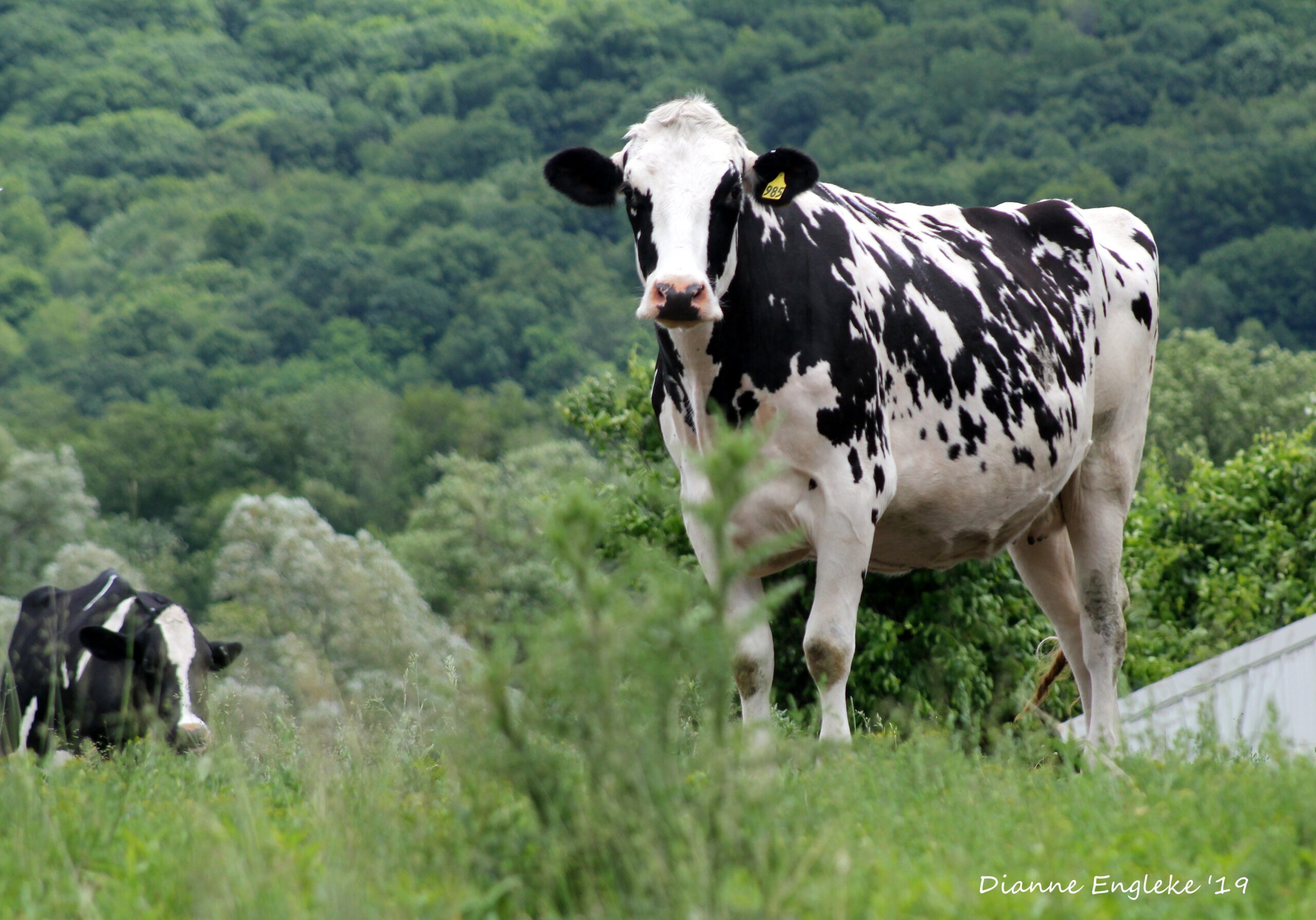
Holstein dairy cows at Willow Brook Farms in North East. Nine of every ten acres in North East is within an Agricultural District.
Emergency Preparedness
As safe as you feel right now, you never know when you will be in an emergency. It is best to have a plan in place ahead of time to help make a stressful or dangerous situation easier to navigate. Dutchess County Government has compiled several resources to help you be prepared in the event of weather related or man-made disaster, including:
Rail Trail
Motorized vehicles not allowed: The 26-mile Harlem Valley Rail Trail is a centerpiece of our local outdoor lifestyle and walkable village, as well as a magnet of regional importance to cyclists, and a key supplier of trade to Millerton businesses. It is specifically a rural rail trail, which is unusual in our often urban and semi-urban society. There is access to the Trail at every road crossing with formal parking in a half dozen places and more to come.
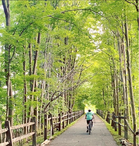
HARLEM VALLEY RAIL TRAIL
HARLEM VALLEY RAIL TRAIL
The Harlem Valley Rail Trail, stretching 26 miles from Wassaic nearly to Hillsdale, is one of the area’s superb outdoor resources.
Complete Streets
Complete Streets is a visionary policy that sees all forms of transportation coexisting safely and equitably whether in a hamlet or dense city center. North East has adopted it, pledging to pursue its design principles wherever possible as the town improves and maintains our roadways.
View the Town policy here or the Village policy here.
Here are some technical and design resources and guides:
- NY State DOT Guidelines for Complete Streets
- Small Town and Rural Multimodal Networks, 2016
-
Walk-Bike Dutchess: The Pedestrian-Bicycle Plan for Dutchess County, 2014 This is a 20-year “vision for improving walking and bicycling conditions in Dutchess County. Key excerpts start on page 242.
Pedestrian Plan
The Millerton Pedestrian Plan is a Dutchess County Transportation Council report which inventoried existing village streets and sets out a vision for improving and enhancing safety and experience for pedestrians.
View the plan here.
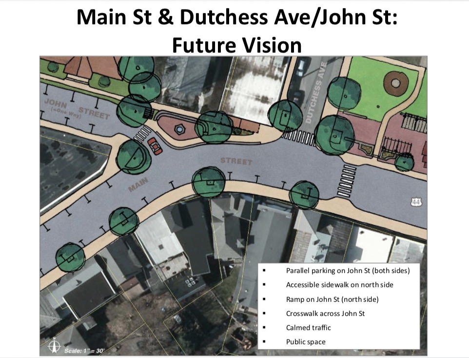
Millerton, an active village at roughly the center point of the Harlem Valley Rail Trail, is a fine stopping place for a stroll and visit to merchants and eateries. Planned pedestrian upgrades will improve sidewalks, crosswalks, and streetscapes.
Greenway Guides
Greenway Guides are from the Dutchess County Planning and Development office. They demonstrate a wide range of best practices for planning and development in a rural community. Individual Guides delve into subjects from considering roads and parking lots to siting buildings and landscaping in commercial and residential neighborhoods.
Here are links to some of the guides:
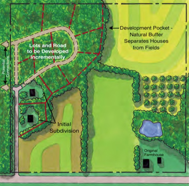
Smart siting can save productive farmland, protect vulnerable habitats and wildlife corridors, and maintain scenic views.